San’in Kaigan UNESCO Global Geopark San’in Kaigan UNESCO Global Geopark

  • Home
  • Outline
    • Outline of Japan and Global Geopark
    • Overview of San’in Kaigan Geopark
    • Valuable and beautiful Geoheritages
    • International geological significance
    • Japanese archipelago separated from the continent
    • Wealth of Ecosystem
    • Unique people’s lives brought about by Geo
  • Geological
    Heritage
    • Kyotango City
    • Toyooka City
    • Kami Town
    • Shin'onsen Town
    • Iwami Town
    • Tottori City
  • Related
    facilities
    • San’in Kaigan Geopark Kyotango City Information Center
    • Genbudo park
    • Kami Town Geopark &Marine Culture Center
    • Shin’onsen Town Sanin Kaigan Geopark Center
    • San’in Kaigan Geopark Museum of the Earth and Sea
    • Iwami Town Nagisa Community Center
    • Tottori Sand Dunes Geopark Visitor Center
    • Aoya Folk Museum
  • Model
    course
    • San’in Kaigan Geopark Trail
    • Walk & Drive Map
  • Practices &
    Activities
  • Operating
    organization
    • Greetings from the representative
    • Introduction of Managing Board and Steering Committee
    • Introduction of constituent groups
    • Introduction of the secretariat “San’in Kaigan Promotion Council”
  • Download
メニュー
  • Japanese

Geological HeritageTottori City

Yoshioka Hot Springs

The Yoshioka Hot Springs are said to have been discovered in 962. Lords of the Ikeda Clan who ruled the Tottori Domain visited the hot springs to heal their fatigue and illness. On the south of the hot spring town, you can observe the Yoshioka Fault, a seismic fault formed by the Tottori Earthquake.

(1)Yoshioka Hot Springs of Inaba Onsenkyo
The Fukube Dune is a coastal dune that is 70 meters in height at its highest point. On the south side of the sand erosion control forest, there are Chinese shallot fields. There used to be a back swamp called Lake Yuyama.
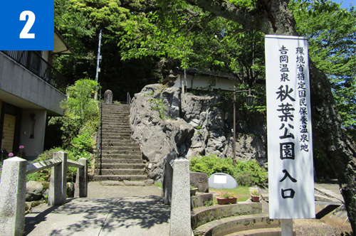
(2)Akibayama Park
Dunes below the volcanic ash layer are old dunes, while dunes above the volcanic ash layer are new dunes. The layer of volcanic ashes consists of Daisen Kurayoshi Pumice accumulated about 50,000 years ago. These ash layer are important for learning about how the Tottori Dunes were formed.

(3)Firefly Festival
This pond was formed when the dunes blocked the water running from the valleys. The pond is about 3.4 km around, and 17 m long at the deepest point. This is the deepest pond in the Chugoku region.

Yoshioka Fault
This a seismic fault formed by the Tottori Earthquake, an M7.2 earthquake that occurred on September 10, 1943. This fault was formed at the same time as the Shikano Fault.

Tottori Convention & Tourism Association

2F Nikko Hondori Building, 160 Suehiro Onsen Town, Tottori City

TEL

0857-26-0756

URL
Geological Heritage
前の記事
次の記事
  • Home
  • Outline
    • Outline of Japan and Global Geopark
    • Overview of San’in Kaigan Geopark
    • Valuable and beautiful Geoheritages
    • International geological significance
    • Japanese archipelago separated from the continent
    • Wealth of Ecosystem
    • Unique people’s lives brought about by Geo
  • Geological
    Heritage
    • Kyotango City
    • Toyooka City
    • Kami Town
    • Shin'onsen Town
    • Iwami Town
    • Tottori City
  • Related
    facilities
    • San’in Kaigan Geopark Kyotango City Information Center
    • Genbudo park
    • Kami Town Geopark &Marine Culture Center
    • Shin’onsen Town Sanin Kaigan Geopark Center
    • San’in Kaigan Geopark Museum of the Earth and Sea
    • Iwami Town Nagisa Community Center
    • Tottori Sand Dunes Geopark Visitor Center
    • Aoya Folk Museum
  • Model
    course
    • San’in Kaigan Geopark Trail
    • Walk & Drive Map
  • Practices &
    Activities
  • Operating
    organization
    • Greetings from the representative
    • Introduction of Managing Board and Steering Committee
    • Introduction of constituent groups
    • Introduction of the secretariat “San’in Kaigan Promotion Council”
  • Download
  • Japanese