San’in Kaigan UNESCO Global Geopark San’in Kaigan UNESCO Global Geopark

  • Home
  • Outline
    • Outline of Japan and Global Geopark
    • Overview of San’in Kaigan Geopark
    • Valuable and beautiful Geoheritages
    • International geological significance
    • Japanese archipelago separated from the continent
    • Wealth of Ecosystem
    • Unique people’s lives brought about by Geo
  • Geological
    Heritage
    • Kyotango City
    • Toyooka City
    • Kami Town
    • Shin'onsen Town
    • Iwami Town
    • Tottori City
  • Related
    facilities
    • San’in Kaigan Geopark Kyotango City Information Center
    • Genbudo park
    • Kami Town Geopark &Marine Culture Center
    • Shin’onsen Town Sanin Kaigan Geopark Center
    • San’in Kaigan Geopark Museum of the Earth and Sea
    • Iwami Town Nagisa Community Center
    • Tottori Sand Dunes Geopark Visitor Center
    • Aoya Folk Museum
  • Model
    course
    • San’in Kaigan Geopark Trail
    • Walk & Drive Map
  • Practices &
    Activities
  • Operating
    organization
    • Greetings from the representative
    • Introduction of Managing Board and Steering Committee
    • Introduction of constituent groups
    • Introduction of the secretariat “San’in Kaigan Promotion Council”
  • Download
メニュー
  • Japanese

Geological HeritageTottori City

Waji

The idyllic landscape of rice paddies, vegetable fields, and houses spreads among the valleys surrounded by mountainous forests. Fossils of the era when the Sea of Japan was formed have been found in the strata of this area.

(1)Kyogahara Canal, rice terraces
There are rice terraces on the steep slopes. The canal was built about 120 years ago by excavating 4 km of the mountainside. Volunteers work is being conducted to preserve the rice terraces and the canal.

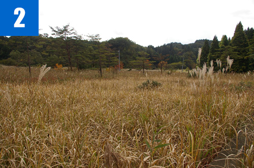
(2)Sugano Sphagnum Wetland
This wetland is located at the end of the plateau formed by lava from Mt. Oginosen, at an altitude of 390 meters. Sphagnum grows in this wetland. It can rarely be seen anywhere else in Tottori Prefecture.

(3)Meotobuchi
You can observe the stratum accumulated in the era when the Sea of Japan was formed (the Fuganji Mudstone Formation formed in the Miocene Epoch of the Neogene Period). Many fossils of marine creatures such as seashells and sea urchins have been found in this stratum.

Tono Dam Walk
Tono Dam is the largest rock-fill dam in the Chugoku region. The walking event was started in 2006 when the construction of the dam started. In this event, you can fully enjoy the rich natural environment and geological features of Tono Dam, nicknamed “Inaba Manyo Lake.”

Tottori Convention & Tourism Association

2F Nikko Hondori Building, 160 Suehiro Onsen Town, Tottori City

TEL

0857-26-0756

URL
Geological Heritage
前の記事
次の記事
  • Home
  • Outline
    • Outline of Japan and Global Geopark
    • Overview of San’in Kaigan Geopark
    • Valuable and beautiful Geoheritages
    • International geological significance
    • Japanese archipelago separated from the continent
    • Wealth of Ecosystem
    • Unique people’s lives brought about by Geo
  • Geological
    Heritage
    • Kyotango City
    • Toyooka City
    • Kami Town
    • Shin'onsen Town
    • Iwami Town
    • Tottori City
  • Related
    facilities
    • San’in Kaigan Geopark Kyotango City Information Center
    • Genbudo park
    • Kami Town Geopark &Marine Culture Center
    • Shin’onsen Town Sanin Kaigan Geopark Center
    • San’in Kaigan Geopark Museum of the Earth and Sea
    • Iwami Town Nagisa Community Center
    • Tottori Sand Dunes Geopark Visitor Center
    • Aoya Folk Museum
  • Model
    course
    • San’in Kaigan Geopark Trail
    • Walk & Drive Map
  • Practices &
    Activities
  • Operating
    organization
    • Greetings from the representative
    • Introduction of Managing Board and Steering Committee
    • Introduction of constituent groups
    • Introduction of the secretariat “San’in Kaigan Promotion Council”
  • Download
  • Japanese