In this Geosite are the ruins of Shikano Castle. The townscape of the old castle town still remains and you can learn the history of the castle. The area of Mt. Jubo and the Kouchi River is a biogeographically important area, since a biogeographic boundary line runs through this area. Different kinds of animals live to the east and west of this line.
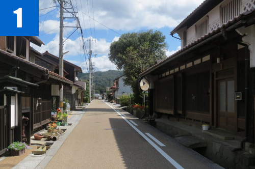
(1)Shikano Castle Town
This is a castle town developed by Kamei Korenori in 1581. The town layout of Tonomachi where samurai houses are located, Kanmachi and Shimomachi where merchants lived, and Shokuninmachi where craftspeople lived are still well preserved. The town houses with Kyoto-style latticework tell you of the atmosphere of the castle town in olden times.
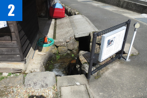
(2)Shikano Fault
This is a seismic fault formed when the Tottori Earthquake, an M7.2 earthquake, struck on September 10, 1943. This fault was formed at the same time as the Yoshioka Fault. A trace of the Shikano Fault, the sliding of the strata of a canal and a stone wall in front of a house in Suemochi, Shikano Town, is designated by Tottori Prefecture as a natural monument.
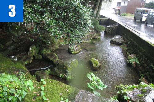
(3)Spring water of Fuse
This water is from the spring at the bottom of a gigantic rock in the precincts of Fusedaira Shrine in the Tono District of Ketaka Town. The water is designated as one of the “Heisei 100 Waters” by the Ministry of the Environment. This area is designated by Tottori Prefecture as a Nature Preservation Area.
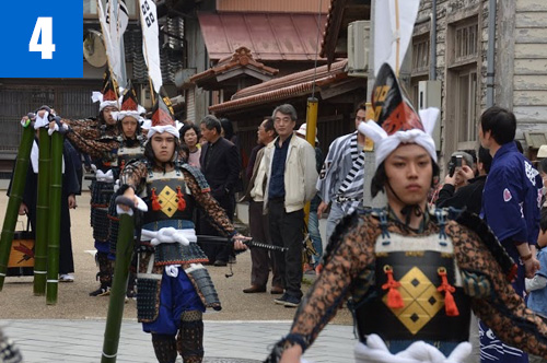
(4)Shikano Festival
This traditional festival is held in spring. People with branches of sakaki, or banners (for the Samurai March) march through the street. The Shishimai dance is also performed. People also proceed around the castle town pulling four floats and carrying portable shrines.


