協議会からのお知らせ
- お知らせ
- 活動報告
- 募集事業
- ガイド講座
- 2024/04/15/
- 2024年度山陰海岸ジオパーク 「ビジネス創出支援事業」を募集します
- 2024/04/10/
- 2024年度山陰海岸ジオパーク 「保護保全活動支援事業」を募集します
- 2024/04/05/
- 2024年度山陰海岸ジオパーク 「次世代青少年等育成支援事業」を募集します
- 2024/04/05/
- 2024年度山陰海岸ジオパーク 「学術研究奨励事業」を募集します
- 2024/04/04/
- 2023年度山陰海岸ジオパーク中高生政策提案・実践コンテストの結果
- 2023/08/29/
- 山陰海岸ジオパーク活動の推進に関する 「パートナーシップ協定調印式」の開催について
- 2023/04/11/
- 【開催報告】山陰海岸ジオパーク参加型イベント「みんなでおしゃべり5」
- 2023/02/10/
- 【イベント案内】竹野スノーケルセンター30周年記念イベント
- 2022/10/07/
- 鳥取市立青谷中学校の生徒達が山陰海岸ジオパークの海を体験しました
- 2022/09/16/
- 山陰海岸ジオパークオーディオガイドを公開!!
- 2024/04/15/
- 2024年度山陰海岸ジオパーク 「ビジネス創出支援事業」を募集します
- 2024/04/10/
- 2024年度山陰海岸ジオパーク 「保護保全活動支援事業」を募集します
- 2024/04/05/
- 2024年度山陰海岸ジオパーク 「次世代青少年等育成支援事業」を募集します
- 2024/04/05/
- 2024年度山陰海岸ジオパーク 「学術研究奨励事業」を募集します
- 2023/07/11/
- 2023(令和5)年度山陰海岸ジオパーク 児童研究作品コンテスト作品募集 ~自分たちの地域を調べてみませんか~
- 2024/01/17/
- 令和5年度 観光列車「あめつち」添乗 山陰海岸ジオパークガイド養成講座《山陰海岸ジオパーク推進協議会》
- 2024/01/10/
- 令和5年度山陰海岸ジオパーク鳥取市ガイド養成講座《鳥取市》
- 2024/01/10/
- 【募集終了】2023年度山陰海岸ジオパークガイド認定講習会in豊岡《豊岡市》
- 2023/11/01/
- 香美町・ジオパークガイド養成講座<山陰海岸ジオパークガイド養成講座>《香美町》
- 2023/10/13/
- 令和5年度 山陰海岸ジオパークガイド養成講座《京丹後市》
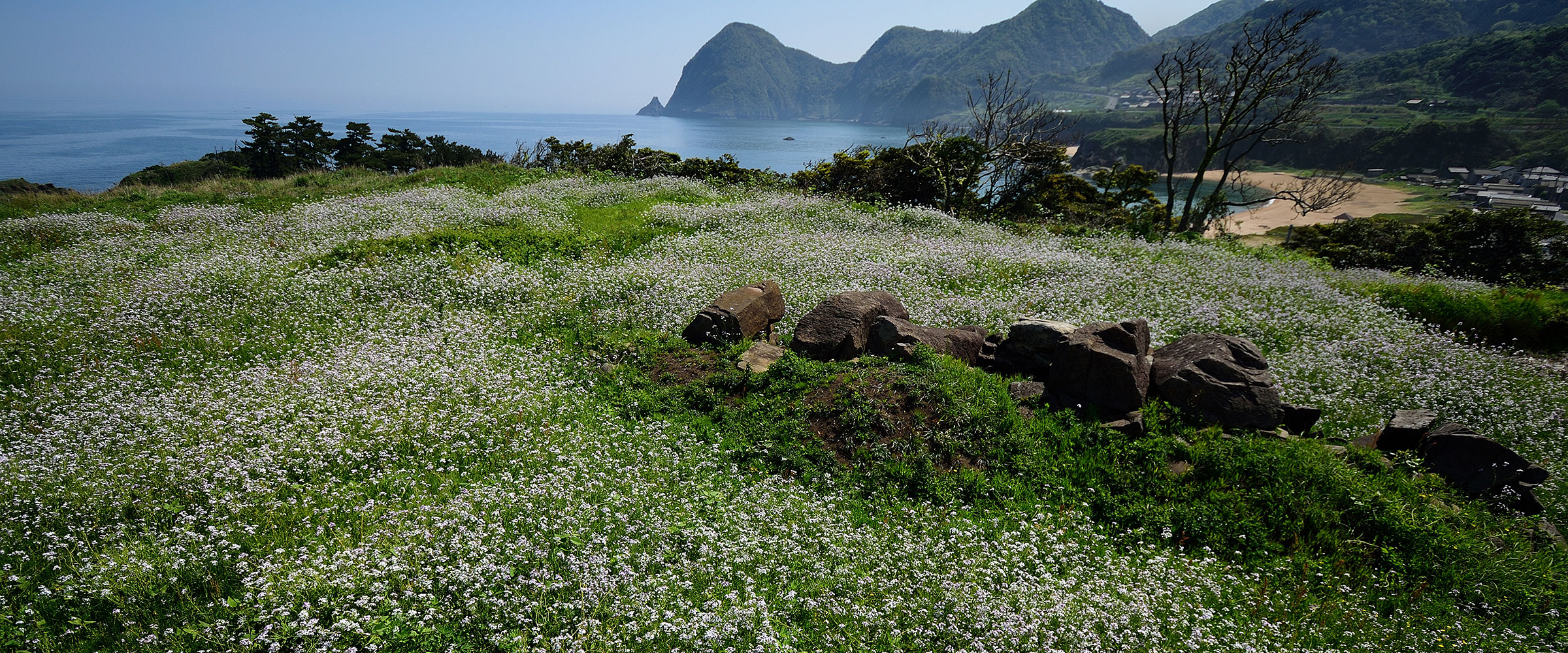
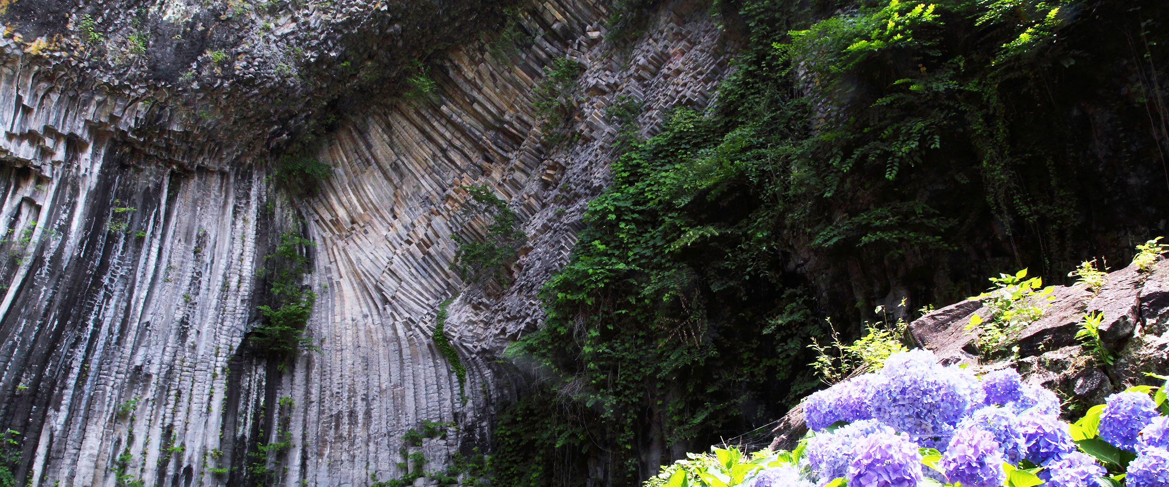
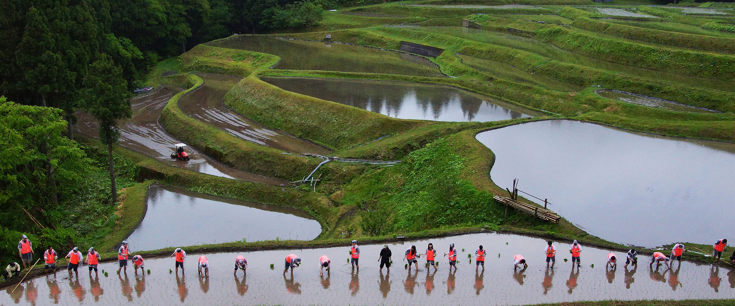
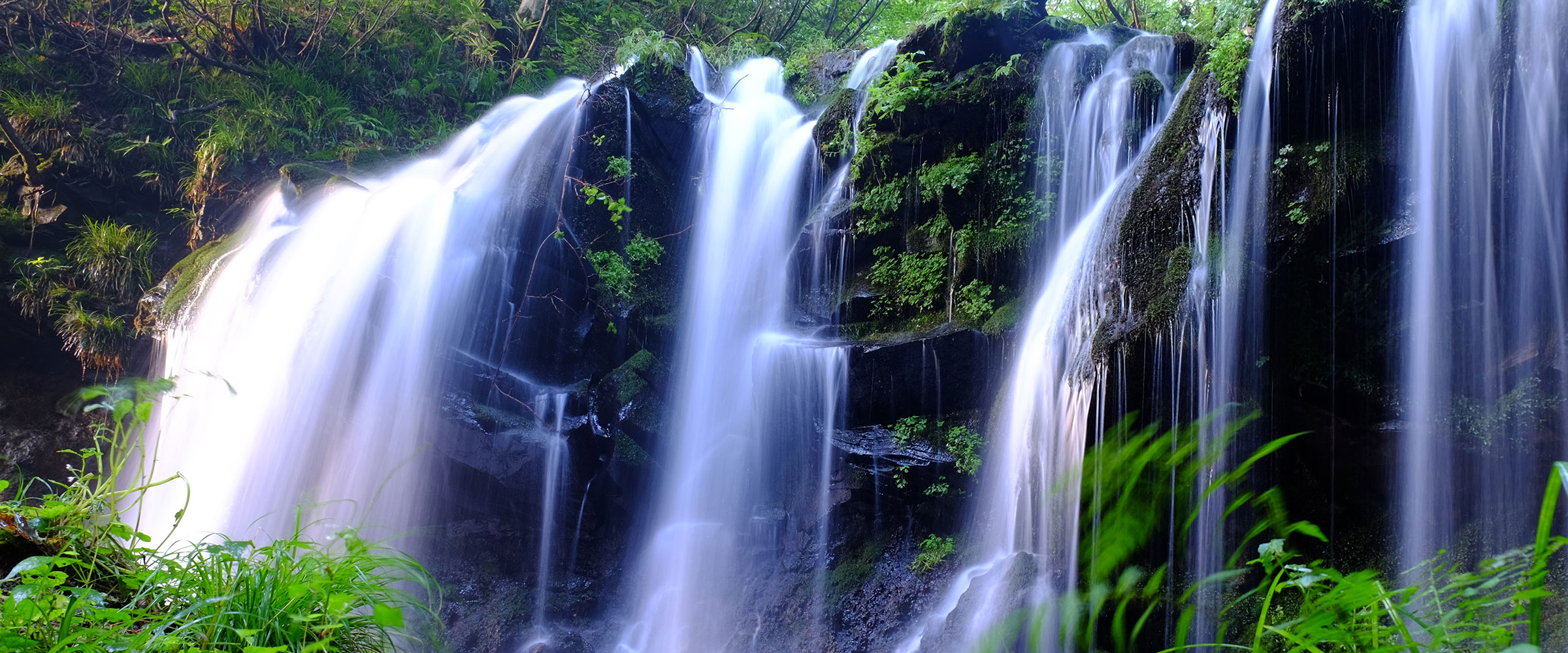
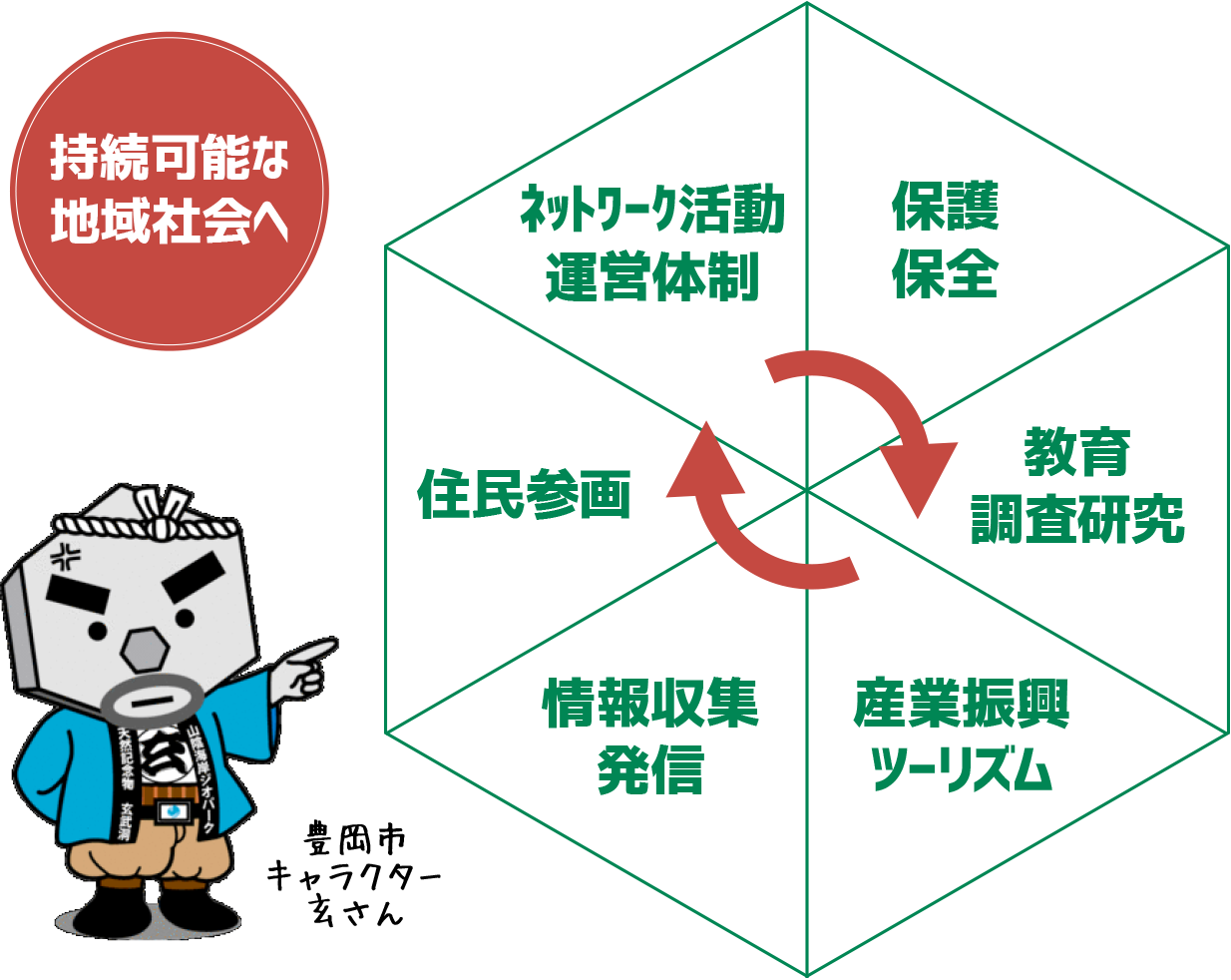
協議会の取り組みについて
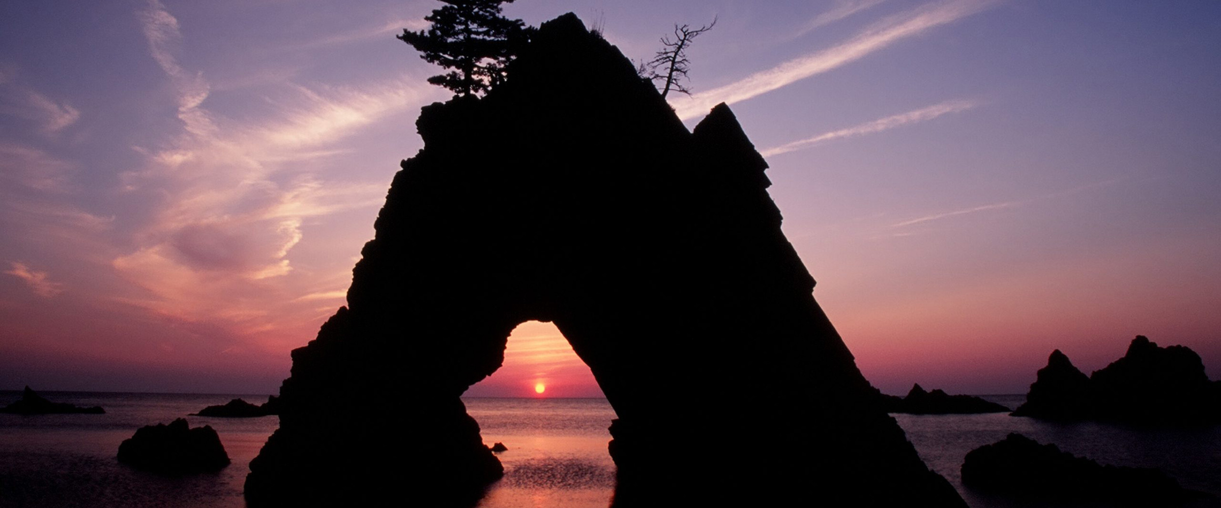
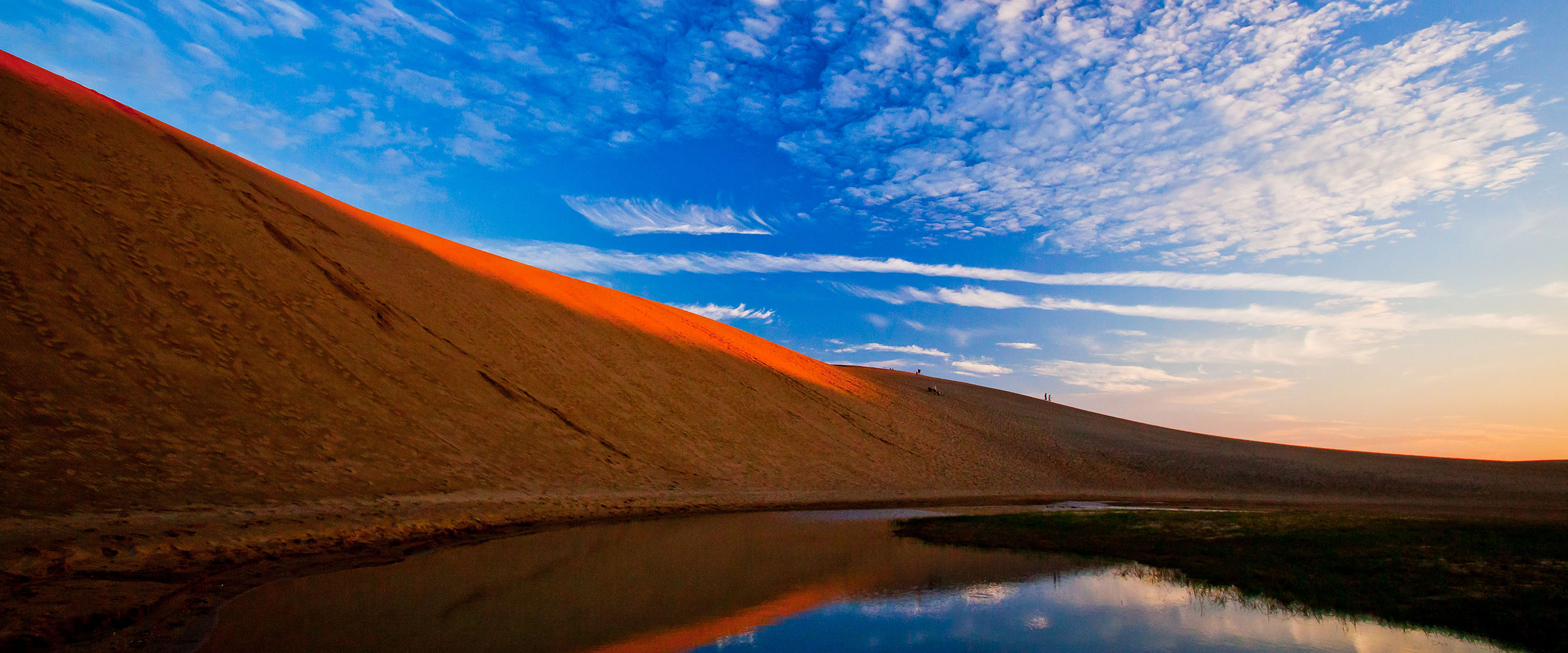
山陰海岸ジオパークでは、
地球活動遺産をはじめとした
多様な地域資源を
地域住民、民間団体、企業、行政が
協働して保全するとともに、
教育、ツーリズム、地域産業に
活用することで、
持続可能な地域社会を目指した
活動が行われています。
マンスリーリレーコラム
ダウンロード